APOLLO 16 LUNAR SURFACE NAVIGATION CHART
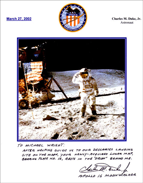
This chart of the lunar surface was USED on board the Lunar Module Orion during the Apollo 16 explorations of the moon during April 1972.
The map measures 10.5 inches by 7.5 inches and was used to aid in the approach to the Descartes landing site. Having served its valuable purpose
it was returned to earth and remained in the possession of Charlie Duke until I was fortunate enough to acquire it.
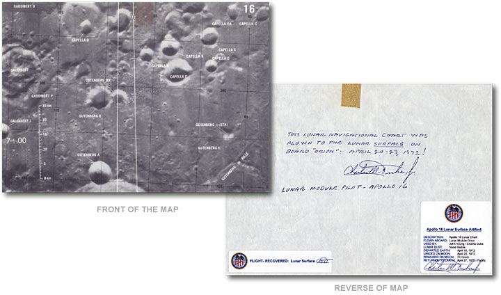
View enlargement of the chart
View enlargement of the reverse
|
|